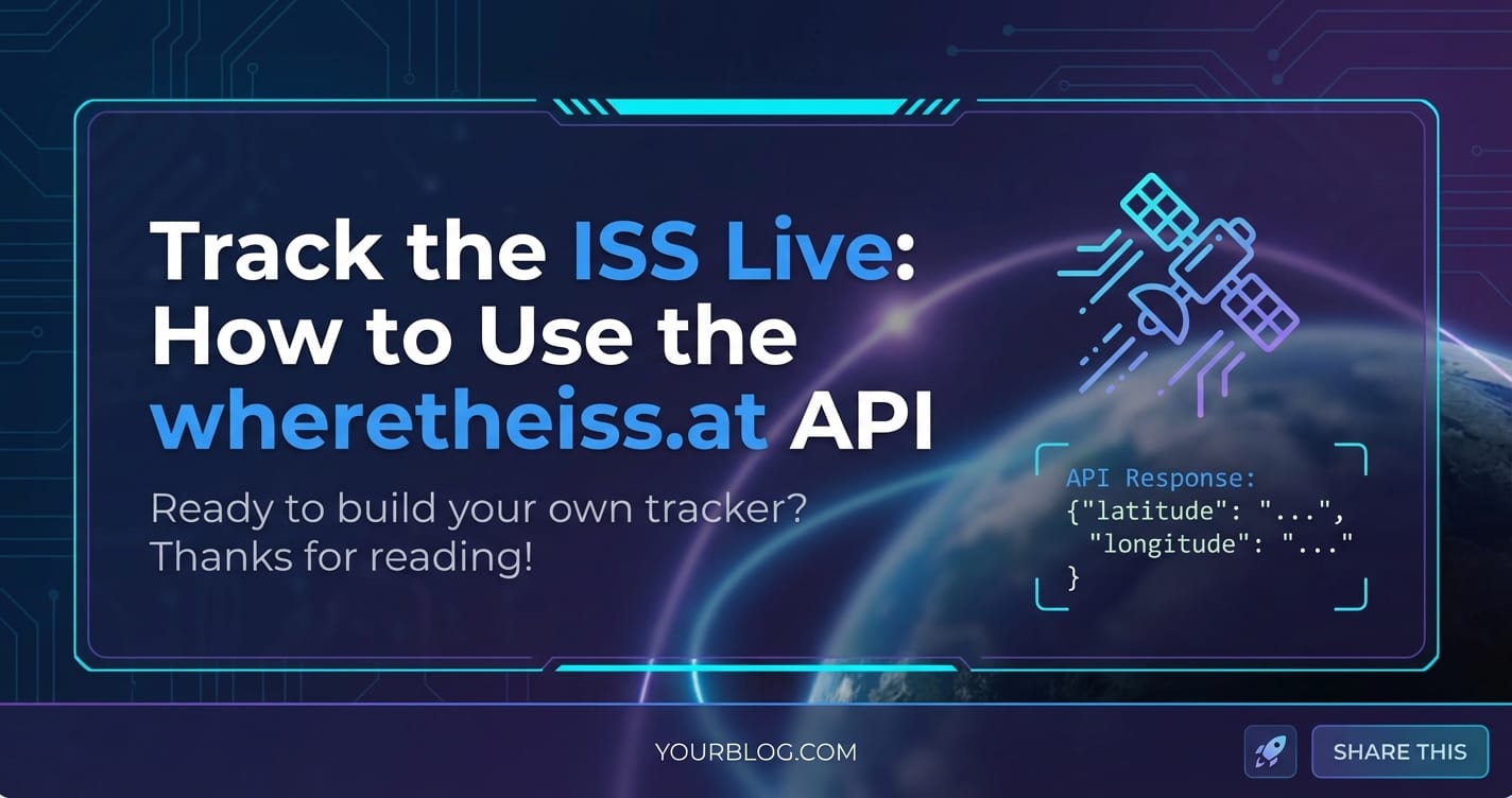
Track the ISS Live: How to Use the wheretheiss.at API


Introduction: Glimpses of Humanity's Orbital Outpost
The night sky has always held a profound allure for humanity, a vast canvas filled with distant stars and enigmatic celestial bodies. Yet, amidst the ancient constellations and wandering planets, there's a modern marvel that streaks across our firmament with breathtaking speed: the International Space Station (ISS). This colossal orbital laboratory, a testament to international collaboration and scientific ingenuity, is a beacon of human presence in space, silently orbiting Earth approximately 16 times a day. Its sheer size and reflective surfaces often make it visible to the naked eye, appearing as a brilliantly moving star, far brighter and faster than any aircraft. For many, catching a glimpse of the ISS is a deeply moving experience, a tangible connection to the cutting edge of space exploration and a reminder of what humanity can achieve when working together.
However, the challenge for an eager observer on the ground lies in knowing precisely when and where to look. With its incredible speed—traveling at roughly 28,000 kilometers per hour (17,500 mph)—and ever-changing orbital path, predicting its exact location at any given moment can seem like a daunting task. While various websites and apps offer predictions, the true power lies in direct, real-time access to its positional data. This is where the concept of an API (Application Programming Interface) becomes not just useful, but indispensable. An API serves as a bridge, allowing different software applications to communicate with each other, requesting and exchanging data seamlessly. In the context of tracking the ISS, an API provides a programmatic gateway to its current coordinates, empowering developers, educators, and space enthusiasts to build their own custom tracking applications, visualizations, or simply satisfy their curiosity with precise, up-to-the-minute information.
This comprehensive guide will delve deep into the fascinating world of tracking the ISS live, with a particular focus on harnessing the simple yet powerful wheretheiss.at API. We'll journey from understanding the grandeur of the ISS itself, through the fundamental principles of APIs, to practical, step-by-step instructions on how to query this API, interpret its responses, and even build dynamic applications that bring the ISS's celestial dance right to your screen. Whether you're a seasoned developer looking for a new project, an educator aiming to inspire students, or simply an avid sky-watcher eager to pinpoint the station's next pass, this article will equip you with the knowledge and tools to connect directly with humanity's orbital home, bridging the gap between Earth and low Earth orbit through the elegant simplicity of an API call. Prepare to unlock the mysteries of the ISS's journey, one latitude and longitude at a time, transforming abstract data into tangible, real-time insights.
Understanding the International Space Station (ISS): A Zenith of Human Endeavor
Before we delve into the technicalities of tracking, it’s crucial to truly appreciate the subject of our pursuit: the International Space Station. More than just a collection of modules and solar arrays, the ISS represents a monumental achievement in human history, a continuously inhabited outpost in low Earth orbit that has profoundly impacted our understanding of space, science, and international collaboration. Its very existence is a testament to the fact that nations, despite their differences, can unite for a common, grander purpose.
A Legacy of Global Collaboration
The genesis of the ISS can be traced back to the post-Cold War era, emerging from the ashes of geopolitical tension as a symbol of renewed cooperation. Initiated by the United States and Russia, the project quickly expanded to include Canada, Japan, and the participating member states of the European Space Agency (ESA). This consortium of 15 nations has invested billions of dollars and countless hours of scientific and engineering expertise to construct and maintain this orbiting research facility. The first module, Zarya, was launched in 1998, and over the subsequent years, a series of complex rendezvous and intricate docking maneuvers assembled the station piece by piece, culminating in the magnificent structure we observe today. Each nation contributed distinct modules and systems, showcasing a diverse range of technological capabilities seamlessly integrated into a single, cohesive habitat. This spirit of cooperation extends beyond construction; daily operations, crew rotations, and scientific experiments are meticulously coordinated across multiple time zones and cultures, making the ISS a truly global enterprise.
Unveiling the Universe: Scientific Endeavors Aboard the ISS
The primary mission of the ISS is to serve as a unique microgravity laboratory, a platform unlike any other on Earth. Scientists from around the globe leverage its unique environment to conduct groundbreaking research across a vast spectrum of disciplines. In the absence of significant gravitational forces, experiments can reveal new insights into material science, fluid dynamics, combustion, and fundamental physics. For instance, studies on crystal growth in microgravity have led to purer, more uniform crystals with potential applications in advanced electronics and pharmaceuticals.
Beyond physical sciences, the ISS is a critical testbed for understanding the effects of long-duration spaceflight on the human body. As humanity eyes missions to the Moon and Mars, data collected on astronaut physiology—bone density loss, muscle atrophy, cardiovascular changes, and psychological well-being—is invaluable. Researchers investigate countermeasures, develop advanced medical technologies, and refine life support systems that will be essential for future deep-space exploration. The station also acts as an unparalleled observatory, with external payloads and experiments continually monitoring Earth's climate, weather patterns, and environmental changes, providing crucial data for climate scientists and disaster relief efforts. From fundamental biological research on cells and plants to the development of new robotics and propulsion technologies, the ISS pushes the boundaries of human knowledge and technological innovation, laying the groundwork for the next giant leaps in space exploration.
Orbital Mechanics: Why the ISS is a Fleeting Spectacle
The ISS doesn't just hang motionless in space; it is in constant, rapid motion, perpetually falling around the Earth. It orbits at an average altitude of approximately 400 kilometers (250 miles) in what is known as Low Earth Orbit (LEO). At this altitude, the Earth's atmosphere, though incredibly thin, still exerts a minute drag force, causing the station to slowly lose altitude over time. To counteract this and maintain its orbit, the ISS periodically performs reboost maneuvers, using thrusters from visiting spacecraft to push it higher.
Its incredible orbital speed of approximately 7.66 kilometers per second (or 27,600 km/h; 17,150 mph) means it completes one full revolution around the Earth roughly every 90 minutes. This speed is precisely what's needed to achieve orbit – a perfect balance between its forward momentum and the Earth's gravitational pull, preventing it from either falling back to Earth or escaping into deeper space. This rapid movement is why its path across the sky changes with each pass and why it appears for such a short duration when visible. The specific ground track—the path projected directly below the station on Earth's surface—shifts slightly eastward with each orbit due to the Earth's rotation beneath it. This dynamic interplay of speed, altitude, and Earth's rotation is what makes tracking the ISS both challenging and endlessly fascinating.
Catching a Glimpse: Factors Affecting Visibility
While the ISS is huge, spanning roughly the size of an American football field including its solar arrays, its visibility from the ground depends on several critical factors. It doesn't generate its own light but reflects sunlight, much like the Moon. Therefore, for it to be visible, two conditions must be met: 1. It must be nighttime at your location: The sky needs to be dark enough for the station's reflected light to stand out. 2. The ISS must be illuminated by the Sun: The station itself needs to be in direct sunlight.
This usually means the best viewing opportunities occur during twilight hours – shortly after sunset or before sunrise – when the sun has dipped below the horizon for observers on the ground, but the ISS, at its higher altitude, is still catching the sun's rays. During midday, it's washed out by the bright sky, and in the middle of the night, both the observer and the ISS are often in Earth's shadow, making it invisible. Other factors like local weather conditions (clouds), light pollution, and the station's exact orbital path relative to your location also play a significant role. Its brightness can rival Venus on a good night, making it an unmistakable, moving star in the sky, a truly inspiring sight that connects us directly to the pioneering spirit of space exploration.
The Power of APIs: Your Digital Messenger for Real-time Data
In an increasingly interconnected digital world, the ability for different software applications to communicate and share information seamlessly is paramount. This capability is largely facilitated by APIs – Application Programming Interfaces. Far from being an arcane technical concept, APIs are the unsung heroes behind much of the digital convenience we experience daily, from checking the weather on your phone to booking a flight or streaming a movie. Understanding what an API is and how it functions is the key to unlocking the potential of vast datasets, including the real-time position of the International Space Station.
What Exactly is an API? An Analogy
Think of an API as a waiter in a restaurant. You, the customer, represent a software application or a program. The kitchen represents the server or database that holds the information you need. You don't go into the kitchen yourself, rummaging through ingredients and cooking equipment to get your meal. Instead, you consult the menu (the API documentation) to see what dishes (data or services) are available. You then tell the waiter (the API) your order (your request for specific data). The waiter takes your order to the kitchen, the kitchen prepares it, and the waiter brings your meal (the data) back to your table in an understandable format.
In this analogy: * You (the application): Want data (e.g., ISS location). * The Menu (API Documentation): Tells you what data you can request and how to request it. * The Waiter (API): The intermediary that processes your request and fetches the data. * The Kitchen (Server/Database): Where the data resides and is processed. * The Meal (Data Response): The information you receive (e.g., latitude, longitude).
This metaphor elegantly illustrates the core function of an API: it defines the methods and data formats that applications can use to request and exchange information, acting as a standardized interface between disparate software components.
Why APIs Are Essential in the Modern Digital Landscape
The ubiquity of APIs stems from their immense benefits in modern software development and data management:
- Data Sharing and Integration: APIs enable different services to share data efficiently. A weather app might use an API from a meteorological service, a travel booking site might integrate with airline APIs, and a fitness tracker might connect to a health API. This interconnectedness creates richer, more functional applications without requiring each developer to build every single component from scratch.
- Automation: By providing programmatic access to services, APIs facilitate automation. Tasks that would otherwise require manual intervention can be scripted to run automatically, saving time and reducing human error. For example, updating inventory across multiple e-commerce platforms can be automated via their respective APIs.
- Innovation and Expansion: APIs open up platforms for third-party developers, fostering innovation. Companies like Google, Facebook, and Twitter provide extensive APIs, allowing countless developers to build new applications and services on top of their core platforms, expanding their ecosystem and reach. This collaborative model accelerates development and leads to diverse applications that the original platform owners might never have conceived.
- Efficiency and Reusability: Developers can reuse existing functionality exposed through APIs instead of reinventing the wheel. This speeds up development cycles, reduces costs, and improves the overall quality of software by leveraging battle-tested services.
- Standardization: APIs typically adhere to established protocols and data formats, ensuring consistency and ease of integration across different systems. This standardization reduces the learning curve for new developers and minimizes compatibility issues.
Types of APIs: A Quick Glimpse, Focusing on REST
While there are various architectural styles for APIs, the most prevalent in web development today is REST (Representational State Transfer). RESTful APIs are widely adopted due to their simplicity, scalability, and statelessness. They leverage standard HTTP methods (GET, POST, PUT, DELETE) to perform operations on resources, which are identified by unique URLs.
- GET: Used to retrieve data (e.g.,
GET /iss/current_location). - POST: Used to send new data to the server (e.g.,
POST /users/new). - PUT: Used to update existing data.
- DELETE: Used to remove data.
The wheretheiss.at API, which we will explore in detail, is a prime example of a simple RESTful API, primarily utilizing the GET method to retrieve the ISS's current position. The data exchanged typically comes in formats like JSON (JavaScript Object Notation) or XML (Extensible Markup Language), with JSON being the most common due to its lightweight nature and readability.
The Request-Response Cycle and Data Formats
When an application wants to interact with a REST API, it sends an HTTP request to a specific API endpoint (a URL). This request includes details like the HTTP method, any parameters required, and sometimes authentication information. The API server receives this request, processes it, retrieves or manipulates the requested data, and then sends back an HTTP response. This response contains a status code (indicating success or failure, like 200 OK or 404 Not Found) and the actual data payload, usually formatted as JSON.
For instance, requesting the ISS location from wheretheiss.at would involve: 1. Request: Your application sends an HTTP GET request to http://api.open-notify.org/iss-now.json. 2. Server Processing: The wheretheiss.at server receives this request, queries its internal systems for the current ISS position, and formats the data. 3. Response: The server sends back an HTTP 200 OK status along with a JSON object containing the timestamp, latitude, and longitude.
Understanding this fundamental request-response cycle is crucial for effectively working with any API, as it forms the bedrock of how applications communicate and share information across the internet. While some APIs might require authentication (e.g., API keys, OAuth tokens) or have strict rate limits, the wheretheiss.at API offers a fantastic starting point due to its simplicity and open access, making it an ideal tool for learning API integration without immediate concerns about complex security protocols or stringent usage policies.
Introducing the wheretheiss.at API: Your Gateway to Orbital Data
Among the myriad of APIs available for various purposes, the wheretheiss.at API stands out for its straightforward functionality and its ability to connect users directly to one of the most compelling real-time datasets imaginable: the current location of the International Space Station. This API offers a simple, unauthenticated gateway to data that fuels countless amateur astronomy projects, educational tools, and even professional applications.
What is wheretheiss.at and Its Purpose?
The wheretheiss.at API is a service provided by the Open-Notify project, which aims to make various space-related data accessible to the public through simple APIs. Its primary function is elegantly simple: to provide the exact real-time latitude and longitude coordinates of the International Space Station. The underlying data for this API is derived from NORAD (North American Aerospace Defense Command) two-line element (TLE) sets, which are mathematical models of orbital paths. These TLEs are frequently updated, allowing the wheretheiss.at service to calculate and disseminate highly accurate, up-to-the-minute position data for the ISS.
The wheretheiss.at service gained popularity precisely because it fulfills a common curiosity with minimal friction. Before such APIs existed, getting real-time orbital data often required specialized software, knowledge of orbital mechanics, or relying on visual predictions from third-party websites. By offering a direct programmatic interface, wheretheiss.at democratized access to this fascinating information, making it possible for anyone with basic programming skills to integrate live ISS tracking into their own projects.
Why Choose This Specific API? Simplicity and Reliability
For developers or enthusiasts looking to track the ISS, the wheretheiss.at API (officially api.open-notify.org/iss-now.json) is often the first and best choice due to several key advantages:
- Simplicity: It has a single, intuitive endpoint for the ISS's current position. There are no complex authentication schemes, no intricate request parameters, and the response format is clean and easy to parse. This makes it an ideal API for beginners to learn API interaction.
- Reliability: As part of the Open-Notify project, it's generally well-maintained and highly available. While any online service can experience downtime,
wheretheiss.athas proven to be a robust source for its specific data. - Open Access: It’s completely free to use and does not require an API key or registration. This significantly lowers the barrier to entry, allowing immediate experimentation and development.
- Real-time Data: The data is updated frequently, ensuring that the coordinates you receive are as close to real-time as practically possible for a publicly available API.
Core Functionality: Providing Current ISS Location Data
The core functionality of the wheretheiss.at API revolves around a single API endpoint that, when queried, returns a JSON object containing the ISS's current location. It's designed to be stateless and idempotent for the GET request, meaning each request for the current position will simply return the most up-to-date information available without affecting previous or future states.
API Endpoint Structure and How to Make a Simple Request
The API endpoint for the current ISS location is straightforward:
http://api.open-notify.org/iss-now.json
To make a simple request to this API, you don't even need complex programming; you can simply paste this URL into your web browser's address bar and press Enter. The browser will make an HTTP GET request to the API server, and the server will return the JSON response directly in your browser window.
Alternatively, for command-line users, the curl utility is an excellent tool for making HTTP requests:
curl http://api.open-notify.org/iss-now.json
Executing this command in your terminal will print the raw JSON response directly to your console. This is often the first step in debugging or quickly checking an API's output.
Data Format: Interpreting the JSON Response
When you make a request to http://api.open-notify.org/iss-now.json, the API will respond with a JSON object. JSON (JavaScript Object Notation) is a lightweight data-interchange format that is easy for humans to read and write, and easy for machines to parse and generate. It's the standard for most modern RESTful APIs due to its simplicity and flexibility.
A typical response from the wheretheiss.at API looks like this:
{
  "message": "success",
  "timestamp": 1678886400,
  "iss_position": {
    "latitude": "45.1234",
    "longitude": "-73.5678"
  }
}
Let's break down each field in this JSON response:
"message": "success": This field is a string indicating the status of the API request. A "success" message confirms that the API processed your request without any issues and is returning valid data. If there were an error, this field might contain an error message, though this particular API is quite robust for its single function."timestamp": 1678886400: This is a Unix timestamp (also known as POSIX time or epoch time). It represents the number of seconds that have elapsed since the Unix epoch (January 1, 1970, 00:00:00 UTC). This timestamp indicates when the ISS position data was recorded. To convert this into a human-readable date and time, you'll need to use specific functions available in your chosen programming language. This precise timestamp is crucial for understanding the freshness of the data."iss_position": This is a nested JSON object that contains the actual geographical coordinates of the ISS."latitude": "45.1234": This string represents the ISS's latitude in decimal degrees. Positive values indicate North, and negative values indicate South. Latitude ranges from -90 (South Pole) to +90 (North Pole)."longitude": "-73.5678": This string represents the ISS's longitude in decimal degrees. Positive values indicate East, and negative values indicate West. Longitude ranges from -180 to +180.
It's important to note that latitude and longitude are returned as strings in this API's response. While many programming languages will happily convert these to numbers automatically when parsing JSON, it's a good practice to explicitly cast them to floating-point numbers if you plan to perform mathematical operations (like plotting on a map) to ensure accuracy and prevent potential type-related errors.
Refresh Rate of the Data
The wheretheiss.at API updates its data frequently to provide near real-time tracking. While the exact update interval isn't explicitly stated to the millisecond, it's generally considered to be updated every few seconds. This rapid refresh rate means that if you repeatedly query the API, you will receive new coordinates reflecting the ISS's continuous movement. However, for most applications, polling the API every 1 to 5 seconds is more than sufficient, balancing data freshness with avoiding unnecessary load on the API server. Overly aggressive polling might be interpreted as abusive behavior, though this particular API is generally quite tolerant given its purpose.
The simplicity and transparent structure of the wheretheiss.at API make it an exceptional tool for developers of all skill levels to engage with real-world, dynamic data. Its clear JSON output with crucial message, timestamp, latitude, and longitude fields provides all the necessary information to build compelling ISS tracking projects, laying a solid foundation for more complex API integrations in the future.
APIPark is a high-performance AI gateway that allows you to securely access the most comprehensive LLM APIs globally on the APIPark platform, including OpenAI, Anthropic, Mistral, Llama2, Google Gemini, and more.Try APIPark now! 👇👇👇
Practical Implementation: Getting Started with the API
Now that we understand the wheretheiss.at API's structure and output, it's time to get hands-on. This section will walk you through practical examples of how to query the API using popular programming languages: Python and JavaScript. These examples will demonstrate how to make the HTTP request, parse the JSON response, and extract the relevant data (latitude, longitude, and timestamp) for further use.
Prerequisites
Before diving into the code, ensure you have the following:
- Basic Programming Knowledge: Familiarity with Python or JavaScript syntax, variables, data types, and control flow.
- A Text Editor or IDE: Such as VS Code, Sublime Text, PyCharm, or even a simple Notepad.
- Python (for Python examples): Installed on your system (Python 3.x recommended). You'll also need the
requestslibrary, which can be installed via pip:pip install requests. - A Web Browser (for JavaScript examples): With developer tools enabled (F12 in most browsers).
Python Example: Fetching and Displaying ISS Location
Python is an excellent language for API interaction due to its clear syntax and powerful libraries. The requests library is the de facto standard for making HTTP requests in Python, simplifying the process significantly.
Let's create a Python script to fetch the ISS's current location:
import requests
import time
from datetime import datetime

# 1. Define the API endpoint URL
ISS_API_URL = "http://api.open-notify.org/iss-now.json"

def get_iss_location():
    """
    Fetches the current location of the ISS from the wheretheiss.at API.
    Returns a dictionary containing 'latitude', 'longitude', and 'timestamp'
    or None if the API call fails.
    """
    try:
        # 2. Make the GET request to the API
        response = requests.get(ISS_API_URL, timeout=5) # Add a timeout for robustness
        response.raise_for_status() # Raise an HTTPError for bad responses (4xx or 5xx)

        # 3. Parse the JSON response
        data = response.json()

        # 4. Check if the API call was successful
        if data.get("message") == "success":
            timestamp = data["timestamp"]
            latitude = float(data["iss_position"]["latitude"])
            longitude = float(data["iss_position"]["longitude"])

            return {
                "timestamp": timestamp,
                "latitude": latitude,
                "longitude": longitude
            }
        else:
            print(f"API returned an error message: {data.get('message', 'Unknown error')}")
            return None

    except requests.exceptions.RequestException as e:
        # Handle network-related errors (e.g., connection error, timeout)
        print(f"Error fetching ISS data: {e}")
        return None
    except ValueError as e:
        # Handle JSON decoding errors
        print(f"Error parsing JSON response: {e}")
        return None
    except KeyError as e:
        # Handle missing keys in the JSON response
        print(f"Missing expected key in API response: {e}")
        return None

def display_location(location_data):
    """
    Prints the ISS location data in a human-readable format.
    """
    if location_data:
        timestamp = location_data["timestamp"]
        latitude = location_data["latitude"]
        longitude = location_data["longitude"]

        # Convert Unix timestamp to human-readable date and time
        dt_object = datetime.fromtimestamp(timestamp)

        print(f"--- Current ISS Location ---")
        print(f"Timestamp (UTC): {dt_object.strftime('%Y-%m-%d %H:%M:%S UTC')}")
        print(f"Latitude: {latitude}°")
        print(f"Longitude: {longitude}°")
        print("-" * 30)
    else:
        print("Failed to retrieve ISS location data.")

if __name__ == "__main__":
    print("Starting ISS live tracker...")
    try:
        while True:
            iss_info = get_iss_location()
            display_location(iss_info)
            # Pause for a few seconds before the next API call
            time.sleep(5) # Query the API every 5 seconds
    except KeyboardInterrupt:
        print("\nISS tracker stopped by user.")
    except Exception as e:
        print(f"An unexpected error occurred: {e}")
Explanation of the Python Code:
- Import Libraries:
requests: Used for making HTTP requests.time: Used for pausing execution (time.sleep()).datetimefromdatetime: Used to convert the Unix timestamp to a human-readable format.
ISS_API_URL: Defines the constant URL for thewheretheiss.atAPI endpoint.get_iss_location()Function:- Error Handling (
try-except): This is crucial for robust API interactions. We wrap the API call and JSON parsing in atryblock to catch potential errors like network issues (requests.exceptions.RequestException), invalid JSON (ValueError), or missing keys (KeyError). requests.get(ISS_API_URL, timeout=5): This is the core of the API call. It sends an HTTP GET request to the specified URL. Thetimeout=5argument is important; it tellsrequeststo give up if the server doesn't respond within 5 seconds, preventing the program from hanging indefinitely.response.raise_for_status(): This method is a convenient way to check if the HTTP request was successful. If the status code indicates an error (e.g., 404 Not Found, 500 Internal Server Error), it raises anHTTPError.response.json(): If the request is successful, this method parses the JSON content of the response body and returns it as a Python dictionary.- Data Extraction: It accesses the
timestamp,latitude, andlongitudevalues from the parsed dictionary. Note the conversion of latitude and longitude tofloatusingfloat(), as they are returned as strings by the API.
- Error Handling (
display_location()Function:- Takes the dictionary returned by
get_iss_location()as input. - Converts the
timestampto adatetimeobject usingdatetime.fromtimestamp(). - Uses
strftime('%Y-%m-%d %H:%M:%S UTC')to format thedatetimeobject into a clean, human-readable string, explicitly stating UTC to clarify the timezone. - Prints the extracted data to the console.
- Takes the dictionary returned by
- Main Execution Block (
if __name__ == "__main__":)- This block ensures the code runs only when the script is executed directly.
- It uses a
while Trueloop to continuously fetch and display the ISS location, simulating a live tracker. time.sleep(5)introduces a 5-second delay between API calls, preventing excessive polling of thewheretheiss.atserver.KeyboardInterrupthandlesCtrl+C, allowing graceful exit of the loop.
JavaScript Example (Browser-based): Displaying ISS Location on a Webpage
For web applications, JavaScript is the language of choice. Modern browsers provide the fetch API for making network requests, which is a powerful, promise-based mechanism.
Let's create an index.html file that fetches and displays the ISS location:
<!DOCTYPE html>
<html lang="en">
<head>
    <meta charset="UTF-8">
    <meta name="viewport" content="width=device-width, initial-scale=1.0">
    <title>Live ISS Tracker</title>
    <style>
        body {
            font-family: Arial, sans-serif;
            display: flex;
            flex-direction: column;
            align-items: center;
            justify-content: center;
            min-height: 100vh;
            background-color: #f4f4f4;
            margin: 0;
            padding: 20px;
            box-sizing: border-box;
        }
        .container {
            background-color: white;
            padding: 30px;
            border-radius: 10px;
            box-shadow: 0 4px 15px rgba(0, 0, 0, 0.1);
            text-align: center;
            max-width: 500px;
            width: 100%;
        }
        h1 {
            color: #333;
            margin-bottom: 20px;
        }
        p {
            font-size: 1.1em;
            color: #555;
            margin-bottom: 10px;
        }
        span {
            font-weight: bold;
            color: #007bff;
        }
        #error-message {
            color: red;
            font-weight: bold;
            margin-top: 15px;
        }
        .loading {
            font-style: italic;
            color: #888;
            margin-top: 15px;
        }
    </style>
</head>
<body>
    <div class="container">
        <h1>Live International Space Station Tracker</h1>
        <p>Last updated: <span id="iss-timestamp">Loading...</span></p>
        <p>Latitude: <span id="iss-latitude">Loading...</span></p>
        <p>Longitude: <span id="iss-longitude">Loading...</span></p>
        <p id="error-message"></p>
        <p class="loading">Fetching data...</p>
    </div>

    <script>
        const ISS_API_URL = "http://api.open-notify.org/iss-now.json";
        const timestampElement = document.getElementById('iss-timestamp');
        const latitudeElement = document.getElementById('iss-latitude');
        const longitudeElement = document.getElementById('iss-longitude');
        const errorMessageElement = document.getElementById('error-message');
        const loadingElement = document.querySelector('.loading');

        async function getIssLocation() {
            errorMessageElement.textContent = ''; // Clear previous errors
            loadingElement.style.display = 'block'; // Show loading message

            try {
                // 1. Make the GET request using fetch API
                const response = await fetch(ISS_API_URL);

                // 2. Check if the HTTP response was successful
                if (!response.ok) {
                    throw new Error(`HTTP error! status: ${response.status}`);
                }

                // 3. Parse the JSON response
                const data = await response.json();

                // 4. Check if the API call was successful based on the 'message' field
                if (data.message === "success") {
                    const timestamp = data.timestamp;
                    const latitude = parseFloat(data.iss_position.latitude);
                    const longitude = parseFloat(data.iss_position.longitude);

                    // Convert Unix timestamp to human-readable date and time
                    const dtObject = new Date(timestamp * 1000); // JavaScript Date expects milliseconds
                    const formattedTime = dtObject.toUTCString(); // Or use toLocaleString() for local time

                    // 5. Update the DOM with the new data
                    timestampElement.textContent = formattedTime;
                    latitudeElement.textContent = latitude.toFixed(4) + '°'; // Format to 4 decimal places
                    longitudeElement.textContent = longitude.toFixed(4) + '°';
                } else {
                    throw new Error(`API error: ${data.message}`);
                }
            } catch (error) {
                console.error("Error fetching ISS data:", error);
                errorMessageElement.textContent = `Error: Could not retrieve ISS data. ${error.message}`;
                timestampElement.textContent = 'N/A';
                latitudeElement.textContent = 'N/A';
                longitudeElement.textContent = 'N/A';
            } finally {
                loadingElement.style.display = 'none'; // Hide loading message
            }
        }

        // Call the function immediately and then every 5 seconds
        getIssLocation(); // Initial fetch
        setInterval(getIssLocation, 5000); // Fetch every 5 seconds
    </script>
</body>
</html>
Explanation of the JavaScript Code:
- HTML Structure: Basic HTML with
divcontainers andspanelements where the ISS data will be displayed. Simple CSS is included for basic styling. - Constants and DOM Elements:
ISS_API_URL: Same API endpoint URL.timestampElement,latitudeElement,longitudeElement,errorMessageElement,loadingElement: References to the HTML elements where the data and messages will be injected.
getIssLocation()Async Function:async/await: Modern JavaScript usesasync/awaitfor handling asynchronous operations likefetchrequests, making the code look more synchronous and easier to read than traditional callback-based methods.- Error Handling (
try-catch-finally): Similar to Python, this block ensures that any network errors, HTTP errors, or JSON parsing issues are caught and displayed to the user. fetch(ISS_API_URL): This is the corefetchAPI call. It returns a Promise that resolves to theResponseobject.response.ok: Checks if the HTTP status code is in the 200-299 range (indicating success). If not, it throws an error.response.json(): Parses the response body as JSON. This also returns a Promise.- Data Extraction: Similar to Python, it accesses the
timestamp,latitude, andlongitude.parseFloat()is used to convert the string coordinates to floating-point numbers. - Timestamp Conversion:
new Date(timestamp * 1000)converts the Unix timestamp (which is in seconds) to a JavaScriptDateobject (which expects milliseconds).dtObject.toUTCString()formats it for display. - DOM Update: The
textContentproperty of the<span>elements is updated with the fetched data..toFixed(4)is used to format the coordinates to four decimal places. finallyblock: Ensures the loading message is hidden regardless of success or failure.
setInterval(getIssLocation, 5000): This line schedules thegetIssLocationfunction to run repeatedly every 5000 milliseconds (5 seconds), providing a live update of the ISS position. An initial callgetIssLocation()is made to display data immediately upon page load.
Summary of JSON Response Fields
For clarity, here's a table summarizing the expected fields in the wheretheiss.at API response:
| Field Name | Type | Description | Example Value |
|---|---|---|---|
message |
string |
Status of the API request. Usually "success". | "success" |
timestamp |
integer |
Unix timestamp (seconds since epoch) when data was recorded. | 1678886400 |
iss_position |
object |
A nested object containing the ISS's geographical coordinates. | {...} |
latitude |
string |
The ISS's latitude in decimal degrees. | "45.1234" |
longitude |
string |
The ISS's longitude in decimal degrees. | "-73.5678" |
These practical examples illustrate how straightforward it is to interact with the wheretheiss.at API in both server-side (Python) and client-side (JavaScript) environments. With these foundational scripts, you can now reliably fetch and display the ISS's real-time location, opening the door for more sophisticated applications and visualizations. The key is understanding the API's contract (what it expects and what it returns) and implementing robust error handling to ensure your applications are resilient to network issues or unexpected data.
Building Advanced Applications and Visualizations
Fetching and displaying the ISS's raw latitude and longitude is a great start, but the real excitement often lies in transforming this data into compelling visual experiences or integrating it into more complex systems. The wheretheiss.at API provides the fundamental building blocks for a wide array of advanced applications, from interactive maps to historical data analysis.
Real-time Tracking on a Map: Bringing the ISS to Life
One of the most popular and visually engaging applications is plotting the ISS's live position on a global map. This immediately contextualizes the abstract coordinates, allowing users to see its path over continents, oceans, and specific geographical locations.
To achieve this, you'll typically integrate the wheretheiss.at API with a mapping API or library. Popular choices include:
- Leaflet.js: An open-source, mobile-friendly interactive map library for web applications. It's lightweight, easy to use, and highly customizable.
- Google Maps Platform: A comprehensive suite of APIs for creating rich, customized maps. It offers extensive features but often requires an API key and adherence to usage policies.
- OpenLayers: Another powerful open-source JavaScript library for web mapping.
Let's outline the general steps for building a real-time ISS tracker with a mapping library (e.g., Leaflet.js, often used with OpenStreetMap data):
- Map Initialization:
- Embed a map container (a
divelement) in your HTML. - Initialize the map with a chosen center point and zoom level.
- Add a tile layer (e.g., from OpenStreetMap) to provide the geographical context.
- Embed a map container (a
- Plotting the ISS Position:
- Use the
wheretheiss.atAPI to fetch the current latitude and longitude. - Create a marker object on the map at the retrieved coordinates. A custom icon (e.g., a satellite image) can enhance the visual appeal.
- Optionally, add a popup to the marker that displays additional information, such as the exact coordinates and the last updated timestamp.
- Use the
- Updating the Position Periodically:
- Set up a
setInterval(in JavaScript) or a continuous loop withtime.sleep(in Python with a GUI framework) to repeatedly fetch new data from thewheretheiss.atAPI. - In each update cycle, retrieve the new coordinates.
- Update the existing marker's position on the map to reflect the ISS's new location. Avoid creating new markers each time; simply move the existing one.
- Refresh the information in the marker's popup.
- Set up a
- Enhancements (Optional but Recommended):
- Prediction Circle: The ISS's position from the API is a single point. You could draw a circle around the current position on the map representing the area where the ISS would be visible from the ground at that moment (the "visibility footprint"). This is a more advanced calculation involving altitude and line-of-sight geometry, but it adds immense value.
- Orbital Path Projection: While the
wheretheiss.atAPI only gives the current position, you could store a series of recent positions and draw a trailing line to show the ISS's recent path. For predicting future paths, you would need more advanced APIs or orbital mechanics libraries that process TLE data directly. - Custom Icons and Animations: Use a custom satellite icon that rotates to match the ISS's orientation (if data is available from another source, though
wheretheiss.atdoesn't provide this) or animate the marker's movement smoothly between updates. - Ground Station Markers: Add markers for major ground control stations or famous landmarks, and calculate the distance to the ISS.
Predicting Future Passes: Beyond Current Location
It's crucial to understand a limitation: the wheretheiss.at API provides the ISS's current location. It does not natively provide functionality for predicting future overhead passes for a specific observer on Earth. This requires more complex orbital calculations, taking into account the observer's precise location (latitude, longitude, altitude) and sophisticated orbital elements (like those found in TLEs).
However, you can combine the wheretheiss.at API with other resources or approaches:
- Dedicated Prediction APIs: Services like
N2YO.comor other satellite tracking APIs offer endpoints specifically for pass predictions. These typically require your location coordinates and return a list of future pass events, including start time, end time, maximum elevation, and brightness. - Orbital Mechanics Libraries: For developers who want full control and understand orbital mechanics, libraries like PyEphem (Python) or satellite.js (JavaScript) can process raw TLE data to calculate future passes. This requires fetching current TLEs for the ISS (available from services like Space-Track.org, though often requiring registration).
- Combining Data Sources: You could use
wheretheiss.atfor live display and a prediction API for planning future observations. Your application could query the prediction API once, then switch towheretheiss.atfor real-time tracking when a pass is imminent.
Data Storage and Analysis: Unveiling Patterns
Collecting the ISS's position data over time opens up possibilities for historical analysis and pattern recognition. You could build an application that:
- Stores Historical Positions: Periodically (e.g., every 10 seconds, every minute) query the
wheretheiss.atAPI and store the timestamp, latitude, and longitude in a database (e.g., SQLite for simplicity, PostgreSQL for scalability, or even a time-series database). - Analyzes Orbital Characteristics:
- Speed and Altitude: While the
wheretheiss.atAPI doesn't explicitly return speed or altitude, with two consecutive data points (timestamp, lat, long), you can calculate the distance traveled and infer average speed over that interval. Altitude data is more complex to derive accurately without additional information. Other APIs likeOpen-Notify's owniss-overheadendpoint provide a rough altitude. - Orbital Decay: Over longer periods, you could observe subtle changes in the ISS's average altitude, demonstrating orbital decay due to atmospheric drag (and subsequent reboosts).
- Ground Track Analysis: Visualize historical ground tracks, identifying patterns in where the ISS flies over most frequently.
- Speed and Altitude: While the
- Visualizes Long-term Paths: Plot thousands of historical data points on a map to show the ISS's complete global coverage over days or weeks, demonstrating how its orbital plane shifts relative to Earth's rotation.
Educational Projects: Inspire and Engage
The ISS provides a fantastic context for educational projects spanning science, technology, engineering, arts, and mathematics (STEAM). An API-driven tracker can be the centerpiece:
- Classroom Displays: A large screen displaying the ISS's real-time position with information about the current crew, ongoing experiments, and upcoming visible passes for the school's location.
- Interactive Learning Tools: Develop web applications where students can click on countries and see when the ISS will pass over, learn about orbital mechanics, or simulate sending data to the station.
- Citizen Science: Encourage students to record their own observations of the ISS and compare them with the predicted data from the API-driven tracker.
- Programming Challenges: Task students with building their own trackers, map integrations, or data analysis scripts using the
wheretheiss.atAPI, fostering practical coding skills.
Managing Complex API Integrations with APIPark
As your projects grow in ambition, you might find yourself integrating with not just one, but multiple APIs. For instance, to build a truly advanced ISS tracking application, you might combine:
wheretheiss.atfor current position.- A weather API to check cloud cover for optimal viewing.
- A prediction API (like N2YO) for future passes.
- A geographical API for reverse geocoding (to show what city the ISS is currently over).
- Perhaps even an AI model (exposed via an API) to generate natural language descriptions of the ISS's current view or potential observations based on its position and other data.
Juggling multiple APIs, each with its own authentication, rate limits, data formats, and documentation, can quickly become overwhelming. This is where an API gateway and management platform like APIPark becomes an invaluable asset.
APIPark simplifies the management of diverse APIs by providing a unified platform. It can act as a single point of entry for your application, routing requests to the correct backend APIs, handling authentication across different services, and even transforming data formats on the fly to provide a consistent interface to your developers. For an ISS project, APIPark could:
- Consolidate Endpoints: Create a single API endpoint for your application that, behind the scenes, calls
wheretheiss.at, the weather API, and the prediction API, then aggregates and returns the combined data to your front-end. - Manage Authentication: If some of your integrated APIs require keys or tokens, APIPark can securely store and inject these credentials into outgoing requests, abstracting away the complexity from your application code.
- Standardize Data: If the weather API returns JSON in one structure and the prediction API in another, APIPark can apply transformations to normalize the data into a single, consistent format for your application.
- Monitor Usage: Track calls to all integrated APIs, providing insights into performance, errors, and usage patterns, which is critical for debugging and scaling.
This kind of API management becomes essential when moving from simple scripts to production-grade applications that rely on a mosaic of external services. By abstracting the complexity of multiple API integrations, APIPark allows developers to focus on building innovative features for their ISS tracker, rather than spending undue time managing infrastructure and integration nuances.
Security, Best Practices, and Future Considerations
Working with APIs, whether for tracking the ISS or building complex enterprise solutions, comes with responsibilities and best practices. Adhering to these principles ensures the reliability, security, and scalability of your applications and respects the resources of the API providers.
API Keys and Authentication
While the wheretheiss.at API is publicly accessible without authentication, many APIs—especially those providing more sensitive data or requiring commercial access—do require API keys or other forms of authentication (like OAuth 2.0).
- What are API Keys? An API key is a unique identifier that authenticates your application or user to an API service. It's usually a string of alphanumeric characters.
- Why are they used?
- Authentication: Verifies that the request is coming from an authorized user or application.
- Authorization: Determines what resources or actions your application is permitted to access.
- Rate Limiting & Monitoring: Allows the API provider to track usage, enforce rate limits, and identify malicious activity associated with specific keys.
- Best Practice: If an API requires a key, never embed it directly in client-side code (like JavaScript in a web browser) or publicly accessible repositories. For server-side applications, store API keys securely in environment variables or a configuration management system, not directly in your source code. If you are managing multiple APIs, platforms like APIPark can securely manage and inject these keys into outgoing requests, centralizing credential management and reducing exposure risk.
Rate Limiting: Respecting API Resources
Most public APIs implement rate limiting, which restricts the number of requests a user or application can make within a given timeframe (e.g., 100 requests per minute). This is essential for protecting the API server from overload, ensuring fair usage for all, and preventing denial-of-service attacks.
- Understanding Limits: Always check the API documentation for specific rate limit policies. Some APIs include rate limit information in their HTTP response headers.
- Implementing Delays: As demonstrated in our Python and JavaScript examples, introduce delays (
time.sleep()orsetInterval()) between your API calls. Forwheretheiss.at, polling every 5 seconds is generally safe and sufficient. - Exponential Backoff: If your application encounters a rate limit error (often an HTTP 429 Too Many Requests status), don't immediately retry. Implement an exponential backoff strategy, waiting progressively longer periods before retrying the request. This prevents you from hammering the API and potentially getting your IP address blocked.
Robust Error Handling: Building Resilient Applications
Real-world applications must be prepared for failures. Network issues, server downtime, invalid requests, or unexpected data formats can all cause API calls to fail.
- Catch Exceptions/Errors: Always wrap your API calls in
try-exceptblocks (Python) ortry-catchblocks (JavaScript) to gracefully handle errors. - Inform the User: When an error occurs, provide clear and informative messages to the user rather than crashing or displaying cryptic error codes.
- Logging: Log errors to a file or a centralized logging service. This helps you monitor your application's health, diagnose issues, and identify recurring problems.
- Retry Logic: For transient errors (e.g., network timeout), implement a retry mechanism, perhaps with exponential backoff, to attempt the request again after a short delay.
Data Validation: Trust, But Verify
Never implicitly trust data received from an external API. While reputable APIs strive for consistency, data formats can change, or unexpected values might appear due to errors on the server side.
- Type Checking: Ensure that numerical values are indeed numbers, strings are strings, etc.
- Range Checking: If a value like latitude should be between -90 and +90, check that it falls within this range.
- Presence Checking: Verify that all expected fields are present in the JSON response before attempting to access them (e.g., using
data.get()in Python or optional chainingdata?.iss_position?.latitudein JavaScript). This preventsKeyErrororTypeErrorexceptions.
Caching Strategies: Optimizing Performance and Reducing Load
For data that doesn't change frequently or where near real-time updates aren't critical, caching can significantly improve performance and reduce the number of calls to the API.
- Client-side Caching: Store API responses in local storage (web browsers) or memory for a short period.
- Server-side Caching: For backend applications, use a caching layer (e.g., Redis, Memcached) to store responses.
- Stale-While-Revalidate: A common strategy where you serve cached data immediately while asynchronously fetching fresh data from the API to update the cache for the next request.
For the wheretheiss.at API, which provides rapidly changing real-time data, aggressive caching is less beneficial. However, if you were integrating with an API that provides, say, the static schedule of upcoming ISS crew rotations, caching that data for a day or week would be highly effective.
Scalability: Designing for Growth
If your ISS tracking application becomes popular, it needs to scale to handle increased user traffic and API requests.
- Asynchronous Processing: For server-side applications, use asynchronous programming models to handle multiple API requests concurrently without blocking.
- Load Balancing: Distribute incoming requests across multiple instances of your application.
- Database Optimization: Ensure your database (if storing historical data) is optimized for performance, with appropriate indexing.
- Distributed Systems: For very high traffic, consider moving to a distributed architecture where components are spread across multiple servers. An API gateway like APIPark provides high performance (rivaling Nginx) and supports cluster deployment, making it an excellent foundation for scalable API-driven applications. It also offers detailed API call logging and powerful data analysis features to monitor and optimize performance as traffic grows.
Privacy and Ethical Considerations
While tracking the ISS doesn't raise significant privacy concerns (it's public data), when working with other APIs, always consider:
- Data Minimization: Only request and store the data you absolutely need.
- User Consent: If collecting user-specific data, obtain explicit consent.
- Data Security: Protect any sensitive data you handle, both in transit and at rest.
The Evolving Landscape of APIs and Data Integration
The world of APIs is constantly evolving. New architectural styles (like GraphQL), new security protocols, and new data formats emerge regularly. Staying updated with industry trends, continuously learning, and experimenting with new tools will keep your API integration skills sharp. The fundamental principles of making requests, handling responses, and managing errors remain constant, but the tools and best practices may shift. Tools like APIPark are at the forefront of this evolution, designed to manage not just traditional REST APIs but also the rapidly growing ecosystem of AI models and their corresponding APIs, offering a future-proof solution for complex integration challenges.
By diligently applying these security measures and best practices, you can ensure that your ISS tracker, and any other API-driven application you build, is not only functional and engaging but also robust, secure, and ready to meet the demands of a dynamic digital environment.
Conclusion: Bridging Earth and Orbit Through Code
Our journey from the awe-inspiring presence of the International Space Station to the intricate workings of a real-time API has demonstrated the remarkable power of modern technology to connect us with the cosmos. The ISS, a shimmering beacon of human endeavor in low Earth orbit, is no longer a distant, unpredictable marvel; thanks to accessible APIs like wheretheiss.at, its every movement can be precisely tracked, visualized, and integrated into our digital lives. This fusion of scientific data and programmatic access transforms abstract orbital mechanics into tangible, interactive experiences.
We've explored the profound significance of the ISS as a global scientific laboratory and a symbol of international collaboration. We then demystified the concept of an API, understanding it as the digital messenger that facilitates seamless data exchange between applications, the very backbone of our interconnected world. The wheretheiss.at API emerged as an exemplary tool: simple, reliable, and openly accessible, making it an ideal starting point for anyone eager to venture into API integration. Through practical, detailed examples in Python and JavaScript, we've shown how to query this API, parse its JSON responses, and extract critical information like latitude, longitude, and timestamp, effectively bringing the ISS's real-time position right to your console or webpage.
Beyond basic tracking, we delved into the exciting realm of advanced applications, envisioning real-time map visualizations, discussions around pass predictions, and the potential for historical data analysis. We also briefly touched upon how managing a growing number of diverse APIs, especially those incorporating cutting-edge AI models, can be streamlined using an API management platform like APIPark. Such platforms are indispensable for consolidating, securing, and scaling your API integrations, freeing you to innovate rather than grapple with infrastructure. Finally, we emphasized the critical importance of security, best practices, and future considerations, ensuring that any API-driven project you embark upon is built on a foundation of robustness, efficiency, and ethical responsibility.
The wheretheiss.at API is more than just a data source; it's an invitation to experiment, learn, and create. It's a testament to the fact that complex, real-world data can be made accessible and actionable with well-designed APIs. Whether you're building an educational tool, a personal sky-watching assistant, or simply satisfying a curiosity about where humanity's orbital home is right now, the ability to directly interface with this data via an API empowers you like never before. So, take these lessons, embrace the spirit of exploration, and use the power of APIs to connect with the International Space Station – a continuous beacon of humanity's enduring journey among the stars.
Frequently Asked Questions (FAQs)
1. What exactly is an API and how does it relate to tracking the ISS?
An API (Application Programming Interface) is a set of rules and protocols that allows different software applications to communicate and exchange data. In the context of tracking the ISS, the wheretheiss.at API acts as a standardized interface to the data servers that continuously track the ISS. When you use this API, your application sends a request to the server, and the server responds with real-time data about the ISS's current latitude, longitude, and the time the data was recorded. This allows developers to build custom trackers, maps, and other applications that display the ISS's live location without needing to understand the underlying complex orbital mechanics or directly access the satellite's telemetry.
2. Is the wheretheiss.at API truly real-time, and how often is the data updated?
The wheretheiss.at API provides near real-time data, meaning the information it returns is very fresh and reflects the ISS's current position with minimal delay. The underlying data, derived from NORAD TLEs, is updated frequently, and the API itself generally provides new coordinates every few seconds. While there might be a minuscule lag due to data processing and network latency, for practical purposes like visual tracking or educational projects, it is considered real-time enough to accurately show the ISS's continuous movement across the globe. For most applications, polling the API every 1-5 seconds is sufficient to maintain a smooth, live-tracking experience.
3. Do I need an API key or any authentication to use the wheretheiss.at API?
No, the wheretheiss.at API (part of the Open-Notify project) is completely open and free to use without any requirement for an API key, registration, or authentication. This makes it an excellent choice for beginners to learn about API integration and for building projects without immediate concerns about security credentials or rate limits (though it's still good practice to respect reasonable polling intervals). While many other APIs do require keys for access and usage tracking, wheretheiss.at simplifies the process for its specific purpose.
4. Can the wheretheiss.at API predict when the ISS will pass over my specific location?
The wheretheiss.at API provides only the current location of the ISS (latitude, longitude, and timestamp). It does not offer functionality to predict future overhead passes for a specific observer on Earth. Predicting passes requires more complex orbital calculations that take into account your precise geographical coordinates (latitude, longitude, and altitude) and often involve detailed orbital element data (like TLEs). For pass predictions, you would need to use specialized satellite tracking APIs (e.g., N2YO.com) or integrate with orbital mechanics libraries that can process TLE data, which are often available from other sources.
5. What are some advanced applications I can build using the wheretheiss.at API, and how can APIPark help?
Beyond simply displaying coordinates, you can build a variety of advanced applications: real-time graphical trackers that plot the ISS on an interactive world map (using libraries like Leaflet.js or Google Maps API), historical data loggers that store ISS positions for later analysis, or educational tools that visualize its orbital path and speed. When your project expands to integrate multiple APIs (e.g., wheretheiss.at for current position, a weather API for visibility conditions, a prediction API for future passes, and potentially an AI model for advanced insights), managing these diverse services can become complex. An API gateway and management platform like APIPark can significantly help by providing a unified platform to manage, secure, and deploy all your APIs. It streamlines tasks like authentication, data format transformations, and traffic management, allowing you to focus on building innovative features for your application instead of wrestling with individual API complexities.
🚀You can securely and efficiently call the OpenAI API on APIPark in just two steps:
Step 1: Deploy the APIPark AI gateway in 5 minutes.
APIPark is developed based on Golang, offering strong product performance and low development and maintenance costs. You can deploy APIPark with a single command line.
curl -sSO https://download.apipark.com/install/quick-start.sh; bash quick-start.sh

In my experience, you can see the successful deployment interface within 5 to 10 minutes. Then, you can log in to APIPark using your account.

Step 2: Call the OpenAI API.