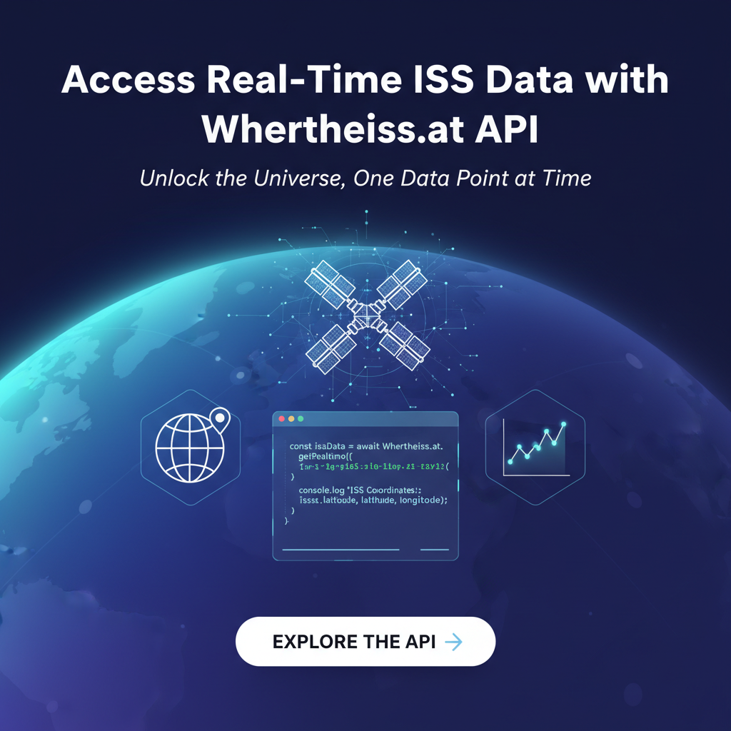
Access Real-Time ISS Data with Wheretheiss.at API


The vast, silent expanse of space has always captivated humanity, inspiring wonder, scientific inquiry, and technological advancement. Among the celestial marvels orbiting our planet, the International Space Station (ISS) stands as a beacon of international collaboration and human ingenuity, a continually inhabited outpost in Earth's low orbit. For enthusiasts, educators, developers, and even casual observers, the ability to track this magnificent orbital laboratory in real-time offers a unique connection to the cosmos. While glancing up at the night sky might occasionally reveal its swift passage, gaining precise, up-to-the-minute information about its location, altitude, and even its current crew requires a more sophisticated approach. This is where the power of an API comes into play, specifically the remarkably accessible Wheretheiss.at API.
This comprehensive guide will delve deep into the world of real-time ISS data access, leveraging the straightforward yet powerful capabilities of the Wheretheiss.at API. We will journey from understanding the fundamentals of the ISS and the transformative role of APIs in modern data exchange, through practical, step-by-step instructions on how to consume this specific API, to exploring a myriad of applications and advanced considerations. Our aim is to provide an exhaustive resource for anyone looking to tap into the live pulse of the International Space Station, transforming raw data into engaging visualizations, insightful analyses, and innovative applications, all while ensuring the content is SEO-friendly and robust enough to satisfy even the most curious minds.
The Celestial Jewel: Understanding the International Space Station
Before we embark on the technical journey of data retrieval, it's crucial to appreciate the subject of our pursuit: the International Space Station. More than just a collection of modules, the ISS is a testament to what nations can achieve when working together, a permanent human presence in space since November 2000. It orbits Earth at an average altitude of approximately 400 kilometers (250 miles), travelling at an astounding speed of about 28,000 kilometers per hour (17,500 mph). This velocity means it completes one full orbit of Earth roughly every 90 minutes, experiencing 16 sunrises and sunsets each day.
The primary purpose of the ISS is to serve as a microgravity and space environment research laboratory, where crews conduct experiments in biology, human physiology, physics, astronomy, meteorology, and other fields. It’s a unique platform for scientific discovery that would be impossible to conduct on Earth. Beyond scientific research, the ISS plays a critical role in fostering international cooperation, with five space agencies – NASA (United States), Roscosmos (Russia), JAXA (Japan), ESA (Europe), and CSA (Canada) – contributing to its construction and operation. Its modular design allows for continuous expansion and adaptation, making it the largest human-made structure in space, visible to the naked eye from Earth as a bright, fast-moving point of light.
The allure of tracking the ISS stems from various motivations. For educators, it's a tangible example of space exploration and orbital mechanics, igniting curiosity in STEM subjects. For amateur astronomers and space enthusiasts, pinpointing its exact location offers the thrill of witnessing human achievement overhead. Developers and data scientists might see it as a fascinating real-time data source for building innovative applications, from interactive maps to predictive models. Understanding its current position not only provides a sense of connection but also enables informed observation, allowing individuals to know precisely when and where to look up to catch a glimpse of this orbiting marvel as it gracefully traverses the night sky. The challenge, of course, lies in its incredible speed and constantly shifting trajectory, making real-time data access not just a convenience, but a necessity for accurate tracking.
The Transformative Power of APIs in Modern Data Access
In today's interconnected digital landscape, data is the new gold, and APIs (Application Programming Interfaces) are the meticulously designed conduits through which this precious commodity flows. Simply put, an API is a set of rules and protocols that allows different software applications to communicate with each other. It defines the methods and data formats that applications can use to request and exchange information. Think of it as a standardized menu in a restaurant: you don't need to know how the kitchen operates; you just need to know what you can order and how to ask for it. The API acts as this menu, abstracting away the underlying complexity of a system and exposing only the necessary functions and data points.
The significance of APIs in modern computing cannot be overstated. They are the backbone of most contemporary web and mobile applications, enabling seamless integration of services and data from disparate sources. From checking the weather on your phone, to booking a flight, to streaming music, APIs are working tirelessly behind the scenes. They facilitate modular development, allowing developers to build applications by combining specialized services rather than reinventing the wheel for every single function. This accelerates development cycles, reduces costs, and fosters innovation by making complex functionalities accessible through simple interfaces.
A key benefit of APIs, especially relevant to our discussion, is their ability to provide real-time data access. Unlike static datasets that require periodic updates, a well-designed API can offer dynamic information, reflecting the most current state of a system or phenomenon. For something as ephemeral and fast-moving as the International Space Station, real-time data is paramount. A few minutes' delay in position data renders it practically useless for precise tracking. APIs bridge this gap, delivering fresh data instantly upon request.
The concept of OpenAPI, often misunderstood as an actual API, refers to the OpenAPI Specification (formerly Swagger Specification). It's a language-agnostic, human-readable specification for describing RESTful APIs. When an API adheres to the OpenAPI Specification, it means its capabilities are formally described in a standard format, which includes available endpoints, operations (GET, POST, PUT, DELETE), parameters, authentication methods, and response structures. This standardization drastically improves API discoverability, understanding, and consumption. While Wheretheiss.at might not explicitly publish an OpenAPI specification, its design principles – clear endpoints, predictable JSON responses, and no authentication requirement – embody the spirit of an open, well-documented, and easily consumable API, making it as user-friendly as any API described by the OpenAPI standard. This commitment to clarity and ease of use democratizes data access, allowing a broad spectrum of users, from seasoned developers to enthusiastic hobbyists, to integrate complex data into their projects without a steep learning curve. The ubiquity of APIs means that once you understand the basic principles, you unlock a universe of data and services, making seemingly complex tasks like tracking an object in space surprisingly accessible.
Diving into the Wheretheiss.at API
Among the myriad of public APIs available, Wheretheiss.at stands out for its elegant simplicity and singular focus: providing real-time data about the International Space Station. It's a prime example of a well-executed, unauthenticated public API that makes complex orbital mechanics digestible for developers. The service is maintained by a dedicated team and has become a go-to resource for anyone looking to integrate ISS data into their applications.
The Wheretheiss.at API offers two primary endpoints, both delivering data in a clean, easy-to-parse JSON format:
/iss-now.json: This endpoint provides the current geographical coordinates (latitude and longitude) of the ISS, along with a timestamp indicating when this position was recorded. It's the most frequently used endpoint for real-time tracking./astros.json: This endpoint provides information about the astronauts currently aboard the ISS. It lists their names and the spacecraft they are on. This offers a human touch to the orbital data, connecting the physical location with the individuals inhabiting it.
Understanding the Data Structure
Let's examine the typical JSON responses from these endpoints to better understand the data you'll receive.
iss-now.json Response Structure:
{
  "message": "success",
  "timestamp": 1678886400,
  "iss_position": {
    "latitude": "40.7128",
    "longitude": "-74.0060"
  }
}
message: A string indicating the status of the request, usually "success".timestamp: An integer representing the Unix timestamp (seconds since January 1, 1970, UTC) when the ISS position was recorded. This is crucial for understanding the freshness of the data.iss_position: An object containing the geographical coordinates:latitude: A string representing the latitude of the ISS. Note that it's a string, so you'll often need to convert it to a float for numerical calculations or mapping.longitude: A string representing the longitude of the ISS. Similarly, convert to float.
astros.json Response Structure:
{
  "message": "success",
  "number": 7,
  "people": [
    {
      "name": "Jasmin Moghbeli",
      "craft": "ISS"
    },
    {
      "name": "Andreas Mogensen",
      "craft": "ISS"
    },
    {
      "name": "Satoshi Furukawa",
      "craft": "ISS"
    },
    {
      "name": "Konstantin Borisov",
      "craft": "ISS"
    },
    {
      "name": "Oleg Kononenko",
      "craft": "ISS"
    },
    {
      "name": "Nikolai Chub",
      "craft": "ISS"
    },
    {
      "name": "Loral O'Hara",
      "craft": "ISS"
    }
  ]
}
message: Similar to theiss-now.jsonendpoint, indicates success.number: An integer indicating the total number of people currently in space (not necessarily all on the ISS, as other craft might be included, though usually it refers to the ISS crew).people: An array of objects, where each object represents an astronaut:name: A string with the astronaut's name.craft: A string indicating the spacecraft they are on (e.g., "ISS").
Making Requests and Rate Limits
The beauty of the Wheretheiss.at API lies in its simplicity. Both endpoints are accessible via standard HTTP GET requests, and critically, they require no authentication. This means you don't need API keys, tokens, or complex authorization headers, significantly lowering the barrier to entry for developers.
You can test these endpoints directly in your web browser: * Open http://api.open-notify.org/iss-now.json * Open http://api.open-notify.org/astros.json
The JSON response will be displayed in your browser, or downloaded, depending on your browser's configuration.
While the Wheretheiss.at API is very permissive, it's good practice to be mindful of rate limits, even if not explicitly stated. Public APIs are shared resources, and excessive requests from a single source can strain their servers. For typical applications, fetching ISS position data every 2-5 seconds should be more than sufficient for real-time tracking, without burdening the API provider. For the astronaut data, this information changes much less frequently, so fetching it once every few minutes or even hours is generally adequate. Responsible API consumption ensures the service remains available and responsive for everyone. The clarity of its structure makes it an excellent candidate for integration into various applications, reflecting the principles of a well-documented OpenAPI experience, even without a formal specification.
Step-by-Step Guide to Consuming the Wheretheiss.at API
Consuming an API might sound daunting to beginners, but with the Wheretheiss.at API, it's remarkably straightforward. We'll use Python for our examples due to its readability and the excellent requests library, which simplifies HTTP requests. However, the principles apply universally across most programming languages.
Prerequisites:
- Basic Programming Knowledge: Familiarity with variables, data types, loops, and conditional statements in any language.
- Python (or chosen language) installed: Python 3 is recommended.
requestslibrary (for Python): If you don't have it, install it via pip:pip install requests.
1. Fetching the Current ISS Position (iss-now.json)
This is the core functionality for real-time tracking. We'll make an HTTP GET request to the /iss-now.json endpoint, parse the JSON response, and extract the relevant data.
import requests
import datetime
import time

def get_iss_position():
    """Fetches and processes the current ISS position data."""
    url = "http://api.open-notify.org/iss-now.json"

    try:
        response = requests.get(url)
        response.raise_for_status()  # Raises an HTTPError for bad responses (4xx or 5xx)

        data = response.json()

        # Check if the API returned a successful message
        if data.get("message") == "success":
            timestamp = data["timestamp"]
            latitude = float(data["iss_position"]["latitude"])
            longitude = float(data["iss_position"]["longitude"])

            # Convert Unix timestamp to human-readable datetime
            dt_object = datetime.datetime.fromtimestamp(timestamp, tz=datetime.timezone.utc)

            print(f"--- ISS Position Data ({dt_object.isoformat()}) ---")
            print(f"Timestamp (UTC): {dt_object}")
            print(f"Latitude: {latitude}°")
            print(f"Longitude: {longitude}°")
            print("-" * 40)

            return latitude, longitude, dt_object
        else:
            print(f"Error: API message indicates failure: {data.get('message')}")
            return None, None, None

    except requests.exceptions.RequestException as e:
        print(f"Error fetching ISS position: {e}")
        return None, None, None
    except ValueError as e:
        print(f"Error parsing JSON or converting data: {e}")
        return None, None, None

# Example usage:
if __name__ == "__main__":
    print("Starting ISS tracking... (fetching every 5 seconds for a minute)")
    for _ in range(12): # Fetch 12 times (1 minute)
        lat, lon, dt = get_iss_position()
        if lat is not None:
            # Here you could update a map, log to a file, etc.
            pass
        time.sleep(5) # Wait for 5 seconds before the next request
    print("Tracking complete.")
Explanation:
- Import Libraries:
requestsfor making HTTP requests,datetimefor handling timestamps, andtimefor pausing execution. - Define URL: The target endpoint
http://api.open-notify.org/iss-now.json. requests.get(url): This function sends an HTTP GET request to the specified URL. The response object contains all the information from the server.response.raise_for_status(): This is a crucial error-handling step. If the server returns an HTTP error status code (like 404 Not Found, 500 Internal Server Error, etc.), this line will immediately raise anHTTPErrorexception, allowing ourtry-exceptblock to catch it.response.json(): Assuming the request was successful and the response body is valid JSON, this method parses the JSON string into a Python dictionary.- Data Extraction: We access dictionary keys like
data["timestamp"]anddata["iss_position"]["latitude"]to get our desired values. Note the conversion of latitude and longitude tofloatas they are initially strings. - Timestamp Conversion: The
timestampfrom the API is a Unix timestamp.datetime.datetime.fromtimestamp()converts it into a human-readabledatetimeobject. We specifytz=datetime.timezone.utcto ensure it's interpreted as UTC. - Error Handling: The
try-exceptblock gracefully handles potential issues:requests.exceptions.RequestException: Catches network errors (e.g., no internet connection, DNS issues).ValueError: Catches errors during JSON parsing or data conversion (e.g., if the response isn't valid JSON or a coordinate isn't a valid number).
- Example Usage: The
if __name__ == "__main__":block demonstrates how to callget_iss_position()repeatedly, simulating real-time tracking with atime.sleep(5)delay between requests. This respects potential rate limits and gives a good feel for "live" data.
2. Fetching Current Astronauts (astros.json)
The process for getting astronaut data is very similar, but the parsing logic changes slightly to iterate through the list of people.
import requests
import time

def get_iss_astronauts():
    """Fetches and processes the current ISS astronaut data."""
    url = "http://api.open-notify.org/astros.json"

    try:
        response = requests.get(url)
        response.raise_for_status()

        data = response.json()

        if data.get("message") == "success":
            number_of_people = data["number"]
            people = data["people"]

            print(f"\n--- Astronaut Data ---")
            print(f"Total people in space: {number_of_people}")
            print("Current crew (on ISS or other craft):")
            for person in people:
                print(f"  - {person['name']} (Craft: {person['craft']})")
            print("-" * 40)

            return people
        else:
            print(f"Error: API message indicates failure: {data.get('message')}")
            return None

    except requests.exceptions.RequestException as e:
        print(f"Error fetching astronaut data: {e}")
        return None
    except ValueError as e:
        print(f"Error parsing JSON or converting data: {e}")
        return None

# Example usage:
if __name__ == "__main__":
    get_iss_astronauts()
    # Astronaut data doesn't change frequently, so a single fetch is often enough.
Explanation:
- Data Extraction: We access
data["number"]for the count anddata["people"]which is a list. - Iterating through people: A
forloop iterates over thepeoplelist, printing each astronaut's name and craft. - Error Handling: Similar
try-exceptblocks are used for robust API consumption.
Best Practices for API Consumption:
- Error Handling is Essential: Always wrap your API calls in
try-exceptblocks. Network issues, server errors, or unexpected response formats can occur. Graceful error handling prevents your application from crashing. - Respect Rate Limits: Even if not explicitly documented, assume there's an implicit rate limit. Polling too aggressively can lead to your IP being temporarily blocked or the API service being degraded for everyone. Use
time.sleep()or similar mechanisms to introduce delays between requests. - Cache Data: For data that doesn't change frequently (like the astronaut list), consider caching the response for a certain period (e.g., an hour). This reduces unnecessary API calls and makes your application faster and more efficient.
- Keep URLs Configurable: Instead of hardcoding URLs, store them in a configuration file or as constants. This makes it easier to update if the API endpoint ever changes.
- Validate Data: After parsing, always validate that the expected keys are present in the JSON response and that the data types are as anticipated. This prevents
KeyErrororTypeErrorif the API response structure changes slightly. - Secure Coding: While Wheretheiss.at is an unauthenticated public API, for APIs requiring authentication, always keep API keys and secrets secure, never hardcoding them directly into your source code in production environments.
By following these steps and best practices, you can reliably and responsibly consume the Wheretheiss.at API, turning real-time ISS data into a valuable asset for your projects. The ease with which this public API can be integrated reflects the benefits of well-designed interfaces, often emphasized in OpenAPI principles, enabling developers to focus on application logic rather than wrestling with complex data access mechanisms.
APIPark is a high-performance AI gateway that allows you to securely access the most comprehensive LLM APIs globally on the APIPark platform, including OpenAI, Anthropic, Mistral, Llama2, Google Gemini, and more.Try APIPark now! 👇👇👇
Practical Applications and Projects
The real-time data from the Wheretheiss.at API opens up a universe of possibilities for creative projects and practical applications. From educational tools to sophisticated data visualizations, here are some ideas, ranging in complexity, that leverage the ISS position and astronaut data:
1. Visualizing ISS Position on a Map
This is perhaps the most intuitive and popular application. Seeing the ISS move across a global map provides an immediate and engaging understanding of its orbit.
- Tools:
- Python: Libraries like
folium(for interactive Leaflet maps) ormatplotlibwithbasemap/cartopy(for static maps). - JavaScript:
Leaflet.jsorOpenLayersfor web-based interactive maps, combined with AJAX requests to fetch API data.
- Python: Libraries like
- Approach:
- Repeatedly fetch the ISS position (
iss-now.json). - Use the latitude and longitude to place a marker on a world map.
- For a truly "real-time" feel, update the marker's position on the map every few seconds.
- Optionally, draw a trail showing the recent path of the ISS, or project its future orbit (though the latter requires more complex orbital mechanics calculations beyond just this API).
- Repeatedly fetch the ISS position (
- Enhancements: Displaying the current time, the speed of the ISS, and perhaps an icon representing the ISS itself. You could also overlay a day/night map to show whether the ISS is currently in sunlight or darkness, which directly correlates to when it's visible from Earth.
2. Desktop Application with Alerts
Imagine an application running on your computer that notifies you when the ISS is about to pass over your location.
- Tools:
- Python:
Tkinter,PyQt, orKivyfor GUI; a library likegeopyto calculate distances, and potentiallyplyerfor desktop notifications.
- Python:
- Approach:
- Obtain the user's current location (e.g., via IP geolocation or manual input).
- Continuously fetch ISS position.
- Calculate the distance between the ISS and the user's location.
- If the distance falls below a certain threshold (e.g., within 500 km), trigger a desktop notification.
- For more accuracy, combine with an API that provides pass predictions (which typically require orbital elements, not directly provided by Wheretheiss.at, but other public APIs exist for this).
- Enhancements: Displaying the duration of visibility, maximum altitude, and direction of approach. A small map in the application could show the relative positions.
3. Web Application Dashboard
A simple web page displaying all current ISS data, accessible from anywhere.
- Tools:
- Frontend: HTML, CSS, JavaScript (with
fetch()orXMLHttpRequestfor API calls). - Backend (optional but recommended for more complex features): Node.js, Python Flask/Django, PHP, etc., to proxy API requests, handle more complex logic, or store historical data.
- Frontend: HTML, CSS, JavaScript (with
- Approach:
- Create a web page layout.
- Use JavaScript to make API calls to Wheretheiss.at (either directly or through your backend).
- Display latitude, longitude, timestamp, and crew list on the page.
- Update the position data dynamically using
setInterval(). - Embed a map using Leaflet.js to show the ISS position.
- Enhancements: Adding a counter for how many times the ISS has orbited since a certain date, or integrating live video feeds from NASA (via other APIs).
4. Educational Tools and Classroom Projects
The ISS provides a perfect context for teaching about orbits, geography, time zones, and programming.
- Tools: Any language or platform suitable for introductory programming.
- Approach:
- Students write scripts to fetch ISS position.
- Calculate the time difference between the ISS timestamp and their local time.
- Plot the ISS path on a static world map by collecting multiple data points over time.
- Display the names and nationalities of the current astronauts.
- Enhancements: Creating a simple command-line tool that continually prints the ISS coordinates, allowing students to observe the data flow. Discussions on why the
latitudeandlongitudefields are strings and require conversion to floats for numerical operations can be valuable lessons in data typing.
5. Data Analysis and Historical Tracking
While the Wheretheiss.at API primarily offers real-time data, you can build a historical dataset by periodically polling the API and storing the results.
- Tools:
- Python:
pandasfor data manipulation,matplotliborseabornfor plotting. - Database: SQLite (local), PostgreSQL, MongoDB, etc., to store collected data.
- Python:
- Approach:
- Set up a script to run every 5-10 seconds, fetching
iss-now.json. - Store the timestamp, latitude, and longitude in a database or append to a CSV file.
- After collecting data for a few hours or days, use
pandasto analyze orbital patterns, speed variations (though less apparent with simple lat/lon), or visualize ground tracks.
- Set up a script to run every 5-10 seconds, fetching
- Enhancements: Calculating the average orbital period, identifying patterns in ground tracks, or correlating ISS passes with local weather conditions (using a separate weather API).
6. IoT Devices
Displaying ISS data on a small screen using an embedded system.
- Tools: Raspberry Pi, ESP32, Arduino (with Wi-Fi module), micro-OLED screen.
- Approach:
- Program the device to connect to Wi-Fi.
- Use a simplified HTTP client library (like
micropython-urequestsfor ESP32) to fetchiss-now.json. - Parse the JSON and display the current latitude, longitude, and timestamp on an LCD or OLED screen.
- Enhancements: A small arrow indicating the cardinal direction of the ISS relative to the device's location, or a simple text-based scroll showing astronaut names.
The simplicity and openness of the Wheretheiss.at API make it an ideal starting point for developers interested in real-time data, space, and creating engaging applications. It embodies the spirit of accessible data, much like the broader principles advocated by the OpenAPI initiative, allowing developers to quickly integrate and build upon existing services.
Enhancing API Consumption and Management with APIPark
As your projects evolve and grow in complexity, particularly when you start integrating multiple APIs, managing the entire ecosystem can quickly become a significant challenge. Imagine a scenario where your ISS tracking application is just one component of a larger system that also pulls in real-time weather data, satellite imagery, astronomical event calendars, and perhaps even leverages artificial intelligence models for predictive analytics, such as forecasting optimal viewing conditions based on atmospheric conditions and orbital data. Each of these external services likely comes with its own authentication mechanisms, rate limits, data formats, and documentation. This is where the true value of an API Gateway and API Management Platform comes into focus.
For developers or enterprises navigating a multitude of APIs, especially when integrating various AI models or managing a complex ecosystem of services, platforms like APIPark become invaluable. APIPark, an open-source AI gateway and API management platform, streamlines the entire API lifecycle. It’s designed to help you not just consume individual APIs like Wheretheiss.at, but to manage, integrate, and deploy a sprawling network of AI and REST services with unparalleled ease and efficiency.
Let's consider how a platform like APIPark could enhance your ISS-related projects and broader API consumption strategies:
- Unified API Management: While Wheretheiss.at doesn't require authentication, many other valuable APIs do. APIPark offers a unified management system for authentication and cost tracking across all your integrated APIs. This means you no longer have to manage separate API keys and authorization flows for each service; APIPark acts as a central control point. If you were combining ISS data with a premium weather API requiring an API key, APIPark would handle the secure storage and injection of that key for every request.
- Simplifying AI Integration: If your project expands to include AI models – for instance, analyzing satellite images for cloud cover, processing natural language descriptions of space events, or even predicting ISS visibility based on historical data and current conditions – APIPark shines. It offers quick integration of 100+ AI models and, crucially, standardizes the request data format across all AI models. This ensures that changes in underlying AI models or prompts do not affect your application's microservices, drastically simplifying AI usage and maintenance costs. You could, for example, encapsulate a prompt that takes ISS coordinates and weather data to generate a human-readable "viewing recommendation" into a new REST API within APIPark.
- End-to-End API Lifecycle Management: As you build more sophisticated applications that consume and perhaps even expose your own APIs (e.g., a consolidated ISS data API for your internal team), APIPark assists with managing the entire lifecycle: design, publication, invocation, and decommission. It helps regulate API management processes, manage traffic forwarding, load balancing, and versioning of published APIs. This ensures that your applications remain stable and scalable, even as the underlying services or your own API versions change.
- API Service Sharing within Teams: In larger organizations or collaborative projects, having a centralized display of all API services is critical. APIPark allows for this, making it easy for different departments and teams to find and use the required API services. Imagine a team building an educational app for a museum, needing to access your consolidated ISS and weather APIs. APIPark provides the portal for them to discover and integrate these services efficiently.
- Performance and Reliability: With an emphasis on performance rivaling Nginx, APIPark can achieve over 20,000 TPS (transactions per second) with modest hardware, supporting cluster deployment to handle large-scale traffic. For applications that require high availability and process a significant volume of API requests from numerous users, this performance is vital. Whether you're fetching ISS data every second for thousands of users or running complex AI inferences, APIPark ensures your gateway is not a bottleneck.
- Detailed API Call Logging and Data Analysis: Understanding how your APIs are being used and performing is crucial for debugging, security, and optimization. APIPark provides comprehensive logging capabilities, recording every detail of each API call. This feature allows businesses to quickly trace and troubleshoot issues in API calls, ensuring system stability and data security. Furthermore, APIPark analyzes historical call data to display long-term trends and performance changes, helping businesses with preventive maintenance before issues occur. This diagnostic capability is invaluable for maintaining the health and efficiency of your API ecosystem.
By centralizing API management, standardizing AI integrations, and providing robust lifecycle governance, APIPark transforms raw data access into sophisticated, enterprise-grade applications. It addresses the architectural and operational complexities that arise when moving beyond a single API call to building comprehensive, data-driven solutions, allowing developers to focus more on innovation and less on infrastructure overhead. The initial ease of using a public API like Wheretheiss.at is a great start, but for serious development, a platform like APIPark provides the necessary foundation for scalable, secure, and efficient API consumption and provisioning.
Advanced Concepts and Considerations
Having mastered the basics of fetching real-time ISS data, we can now look at more advanced concepts that extend the utility and depth of your projects. These considerations push beyond simple data display, moving towards more insightful analysis and sophisticated integrations.
1. Data Visualization Techniques Beyond Basic Maps
While placing a dot on a map is effective, advanced visualizations can reveal more nuanced insights and create more compelling experiences.
- 3D Globe Visualization: Instead of a flat 2D map, imagine a 3D globe where the ISS orbits in real-time. Libraries like
CesiumJS(JavaScript) or tools that integrate withWebGLcan create stunning, interactive 3D representations, showing altitude and perspective more accurately. This allows users to "fly alongside" the ISS. - Orbital Ground Tracks with Predictive Elements: While the Wheretheiss.at API provides current position, you can combine this with orbital mechanics libraries (e.g.,
skyfieldin Python) that, given initial orbital elements (from other sources like NORAD TLEs), can predict the future path of the ISS. Visualizing this predicted path on a map alongside the current real-time position offers valuable context. - Heat Maps of Visibility: By collecting historical data of ISS passes over various locations and cross-referencing with local weather, you could generate a "heat map" showing regions with historically high ISS visibility, aiding in planning future observations.
- Temporal Visualizations: Plotting ISS position over time in a way that shows its path relative to geographical features, or creating animations that compress hours of orbit into seconds, can highlight patterns that static images miss.
2. Time-Series Data Collection and Analysis
As mentioned earlier, collecting ISS data over extended periods transforms individual snapshots into a rich time-series dataset.
- Orbital Period Analysis: By logging timestamps and positions, you can calculate the precise orbital period of the ISS over different days or weeks. Subtle variations might hint at atmospheric drag or reboost maneuvers.
- Ground Track Variation: Analyze how the ISS ground track shifts over successive orbits and days due to Earth's rotation and orbital mechanics. This can be used to explain why the ISS isn't visible from the same location at the same time every day.
- Correlation with Events: Cross-reference ISS passes with global events, geographical phenomena, or even specific scientific experiments taking place onboard (if public data is available). Did a particular experiment run when the ISS was over a specific region?
3. Predictive Analytics: Beyond Simple Tracking
While direct prediction isn't a feature of Wheretheiss.at, the data it provides serves as a foundation for more complex predictive models.
- Pass Prediction: The most common predictive application is forecasting when the ISS will pass over a specific location. This requires processing Two-Line Elements (TLEs), which are orbital parameters published by NORAD. While not from Wheretheiss.at, integrating a TLE-processing library (like
pyephemorskyfieldin Python) alongside the real-time data allows for precise pass predictions. The real-time data from Wheretheiss.at can then be used to "snap" the predicted orbit to the current actual position, improving accuracy. - Visibility Forecasting: Combining pass predictions with weather data (cloud cover, atmospheric conditions from a weather API) and light conditions (day/night, local twilight) can create a comprehensive visibility forecast, telling users not just when to look, but if they'll actually see it.
- Trajectory Correction Detection: By continuously logging ISS position, deviations from a predicted orbit could signal orbital maneuvers (reboosts or adjustments). This could be used to alert users or analyze mission operations.
4. Combining with Other APIs
The true power of API integration lies in combining data from multiple sources to create a richer experience.
- Weather APIs: As mentioned, fetch local weather conditions to enhance visibility predictions.
- Geocoding/Reverse Geocoding APIs: Convert latitude/longitude to human-readable addresses or place names (e.g., "ISS is currently over Berlin, Germany") and vice-versa.
- Astronomical Event APIs: Correlate ISS passes with meteor showers, planetary alignments, or other celestial events.
- Satellite Imagery APIs: Display satellite imagery of the ground directly beneath the ISS's current position.
- NASA APIs: NASA provides a wealth of public APIs for various space-related data, images, and missions. These could be integrated for broader space exploration contexts.
5. Scalability and Production Considerations
For projects intended for a larger audience or requiring high reliability, consider these points:
- Load Balancing and Caching: For web applications serving many users, implement load balancing if you have multiple instances of your backend. Employ robust caching strategies for data that doesn't change every second (like astronaut data, or even aggregated ISS position data over longer intervals).
- Robust Error Monitoring: Set up automated monitoring and alerting for your application and API calls. If the Wheretheiss.at API starts returning errors or goes offline, you should be notified immediately.
- Data Storage and Archiving: If collecting historical data, consider efficient database solutions. For long-term archiving, think about data compression and cost-effective storage.
- Security (if exposing your own APIs): If you build a service that uses Wheretheiss.at data and then exposes it via your own API, ensure proper authentication, authorization, and rate limiting for your users. Platforms like APIPark are excellent for managing these aspects, especially for more complex OpenAPI compliant services.
- Cloud Deployment: Deploying your applications on cloud platforms (AWS, Azure, GCP, etc.) offers scalability, reliability, and global reach. Services like serverless functions (AWS Lambda, Azure Functions) can be cost-effective for event-driven API polling and processing.
By venturing into these advanced concepts, you can transform a simple API integration into a powerful, insightful, and highly functional application that pushes the boundaries of real-time space data utilization. The Wheretheiss.at API serves as an excellent entry point, but the journey through API consumption, management, and innovative application is truly limitless.
The Future of Space Data and APIs
The advent of accessible public APIs like Wheretheiss.at marks a significant shift in how we interact with, understand, and apply complex scientific data. Historically, tracking orbital objects required specialized software, technical expertise, and often proprietary data sources. Today, the democratization of space data through well-documented, public-facing APIs has opened up new frontiers for innovation, education, and public engagement.
We are entering an era where space-based assets, from communication satellites to Earth observation platforms, are becoming increasingly vital to our daily lives. With this growth comes an explosion of data – from detailed climate measurements and geological surveys to real-time imagery and telemetry from hundreds of thousands of orbiting objects. APIs are the essential interface for harnessing this deluge of information. They transform raw, often esoteric, data into consumable, actionable insights for a diverse range of users, not just aerospace engineers.
The future will likely see:
- More Sophisticated and Granular APIs: Beyond basic position and crew data, we can anticipate APIs that offer more granular information, such as detailed sensor readings from the ISS, precise attitude data, specific experiment schedules, or even the ability to query historical data directly from the source rather than building it ourselves.
- Standardization via OpenAPI: As the number of space-related APIs grows, the adoption of specifications like OpenAPI will become even more critical. This will ensure consistency, improve automated tool generation (SDKs, documentation), and reduce the integration effort for developers, fostering a more vibrant ecosystem of interoperable space applications.
- Integration of AI and Machine Learning: Artificial intelligence will play an increasingly prominent role in processing, interpreting, and predicting space phenomena. APIs will serve as the conduits for feeding raw satellite data into AI models and for delivering the processed, intelligent outputs back to applications. Platforms like APIPark, with their focus on AI gateway functionalities, are already laying the groundwork for this integrated future.
- Rise of Commercial Space Data Platforms: As private companies launch their own constellations of satellites (e.g., Starlink, Planet Labs), they too are making their data accessible via APIs, creating new opportunities for commercial applications in fields like agriculture, urban planning, disaster response, and environmental monitoring.
- Enhanced Public Engagement: The ease of accessing and visualizing space data will continue to fuel public interest in space exploration, science, and technology. Educational tools, citizen science projects, and personal tracking applications will become even more immersive and informative.
The Wheretheiss.at API is a simple yet powerful example of this trend. It demonstrates how a small, focused service can unlock significant value and inspire countless projects. As technology advances and humanity's presence in space expands, APIs will remain the critical interface, allowing us to connect with the cosmos, understand our planet better, and build the future of space exploration, one data point at a time. The ability to programmatically access and interpret this data is not merely a technical skill but a gateway to a deeper, more interactive relationship with the universe around us.
Conclusion
Our journey through the world of accessing real-time International Space Station data has illuminated the remarkable simplicity and profound impact of the Wheretheiss.at API. We began by appreciating the monumental achievement that is the ISS, understanding its purpose and the sheer dynamism of its orbit. We then delved into the foundational role of APIs, recognizing them as the indispensable conduits for modern data exchange, and highlighted the importance of principles akin to those championed by the OpenAPI specification for making data accessible and understandable.
Through practical, step-by-step examples using Python, we demonstrated precisely how to fetch the ISS's current geographical position and the names of its courageous crew members. We explored a diverse array of practical applications, from interactive map visualizations and desktop alerts to web dashboards, educational tools, and the potential for deep data analysis, showcasing how raw data can be transformed into engaging and insightful experiences. Critically, we also discussed how as projects grow, especially when integrating multiple APIs or complex AI models, platforms like APIPark become indispensable for comprehensive API management, ensuring scalability, security, and efficiency. Finally, we peered into the future, anticipating an even greater proliferation of space data accessible through sophisticated APIs, further democratizing our connection to the cosmos.
The Wheretheiss.at API is more than just a data source; it's an invitation. An invitation for developers, educators, and space enthusiasts alike to engage directly with the ongoing narrative of human spaceflight. It exemplifies how modern technology can bridge the vast distances of space, bringing the wonder of the International Space Station directly to our screens. Whether you're building a simple tracker for personal curiosity, developing an educational resource, or laying the groundwork for a complex, data-driven application, the power to access real-time ISS data is now readily at your fingertips. Embrace this power, experiment, and contribute to the ever-growing ecosystem of applications that connect us to the boundless frontiers above.
FAQ
Q1: What is the Wheretheiss.at API and what data does it provide? A1: The Wheretheiss.at API is a free, publicly accessible API that provides real-time data about the International Space Station. Its main endpoints offer the current geographical latitude and longitude of the ISS (/iss-now.json) and a list of astronauts currently in space (/astros.json). This data is returned in a straightforward JSON format, making it easy to integrate into various applications.
Q2: Do I need an API key or authentication to use the Wheretheiss.at API? A2: No, one of the primary advantages of the Wheretheiss.at API is its simplicity. It does not require any API keys, tokens, or authentication whatsoever. You can make HTTP GET requests directly to its endpoints, which significantly lowers the barrier to entry for developers and makes it ideal for quick projects and learning.
Q3: How often should I request data from the Wheretheiss.at API? Are there rate limits? A3: While the Wheretheiss.at API doesn't explicitly state strict rate limits, it's always best practice to be a responsible consumer of public APIs. For tracking the ISS position, fetching data every 2-5 seconds is generally sufficient for a real-time feel without overburdening the server. For astronaut data, which changes infrequently, polling once every few minutes or even hours is more than adequate. Excessive requests can lead to temporary IP blocks or degradation of service for others.
Q4: What programming languages or tools can I use to access this API? A4: Because the Wheretheiss.at API uses standard HTTP GET requests and returns JSON data, you can use virtually any programming language or tool that can make web requests and parse JSON. Popular choices include Python (with the requests library), JavaScript (with fetch() or XMLHttpRequest), Ruby, PHP, Java, C#, and even command-line tools like curl. The simplicity of the API makes it highly versatile.
Q5: What are some practical applications I can build with the Wheretheiss.at API? A5: The possibilities are vast! You can build interactive web maps to visualize the ISS's real-time position, create desktop applications that send alerts when the ISS is overhead, develop educational tools for classrooms, collect historical data for analysis of orbital patterns, or even integrate the data into IoT devices with small displays. The API serves as an excellent foundation for projects that connect people to space exploration.
🚀You can securely and efficiently call the OpenAI API on APIPark in just two steps:
Step 1: Deploy the APIPark AI gateway in 5 minutes.
APIPark is developed based on Golang, offering strong product performance and low development and maintenance costs. You can deploy APIPark with a single command line.
curl -sSO https://download.apipark.com/install/quick-start.sh; bash quick-start.sh

In my experience, you can see the successful deployment interface within 5 to 10 minutes. Then, you can log in to APIPark using your account.

Step 2: Call the OpenAI API.